Each mini project I start seems to warrant yet another big one. The fireplace led to the need for a library and an entire house; the house led to the new website; and now I’m starting a whole new subject, but don’t worry, I haven’t abandoned the other ones.
As the project continues and the story starts to develop, the need for a map and an overall better understanding of the city layout has presented itself. But, in order to even think about the way a city grows through roads and buildings, I needed to first learn about the geographical region since that’s what I’m building on top of.
Virginia’s mountains are the result of ancient tectonic shifts that occurred millions of years ago and have a direct impact on the cultural evolution of the region. The barrier that the Blue Ridge Mountains creates helped to alter the course of Native American settlement, trade routes, and immigrant populations. The “cause and effect” never stops, and it’s the reason why I take a fictional map so seriously. The historical context of how the region developed will and should have an influence on the way Autumn progresses in the future, and like a city that’s been around for a while, it’s hard to change the framework late in the game.
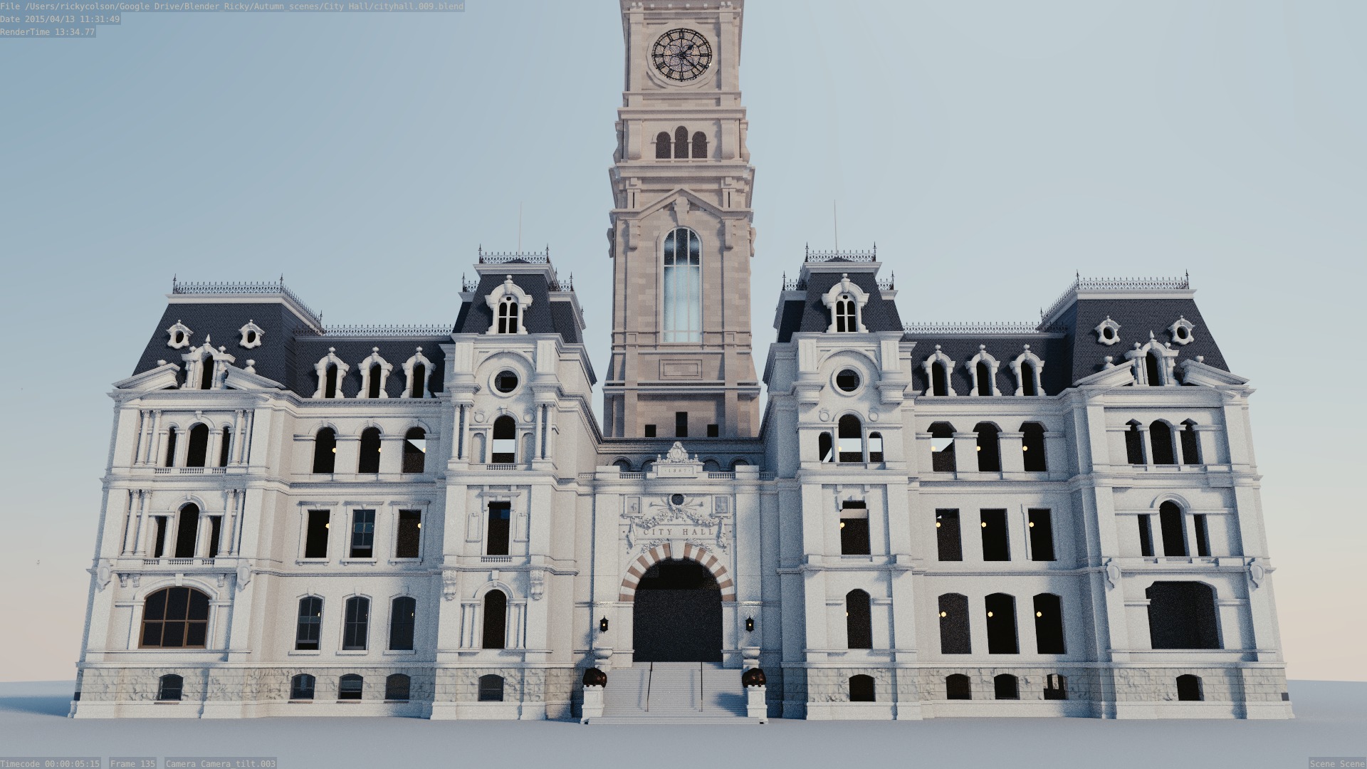
I started sketching city layouts many months ago, playing around with grid structures and buildings placements. I’m at the point now where I needed to start laying down a permanent foundation to build the story, characters, and city on top of. That’s no easy task.
American cities area laid out in vastly different ways, with block sizes and sidewalk widths varying from one city to another and sometimes within their own city limits. What’s the best size? What fits the historical period? Do I go with a grid structure more common to utopist urban planners of the 19th century or more of an organic unplanned style reminiscent of ancient European cities?
The city layout plays an important role in my story so I wanted to take advantage of recreating the linear process that every city goes through, especially earlier ones like New York. New York is famous for its rigid grid structure and straight, long streets. This was intentional and part of the original plan. The Commissioner’s Plan of 1811 was proposed by the New York legislature for the orderly development and sale of land of Manhattan. It is different than L’ Enfant’s Beax-Arts style plan in DC where diagonal streets cut across the city with avenues and parks taking dominance. The layout of a city defines the future soul of the city.
I’ll go into more of my vision for Autumn’s urban planning further down the road, but for now I’m working on the actual foundation, the land itself. Once I started to plan the road widths, lot sizes, and other surveying necessities, I looked to real structures to model. The USGS is a wonderful resource, providing topographical maps and other terrain information. I’m spending some time scouting specific locations, building terrain in 3d space, and double checking to make sure my scale is accurate from the start. From here I can draw a plan with roads and buildings and then let the story grow from there.
This is yet another juggling act. I’m working on some historical back story, geographical construction, and city planning – all with a vision of where the city needs to go in the future. More to come…